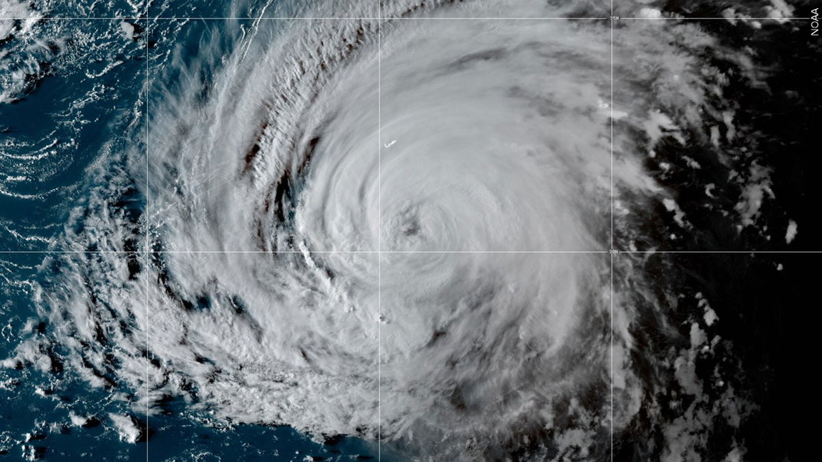
Tropical Storm Ian strengthens in the Caribbean and tracks toward Florida

By Derek Van Dam and Haley Brink, CNN meteorologists
(CNN) - The ninth named tropical storm of the 2022 Atlantic hurricane season has formed across the central Caribbean Sea, and forecasts show Florida may soon be impacted by its first major hurricane since 2018.
Tropical Storm Ian was located about 315 miles (510 km) southeast of Kingston, Jamaica, as of 5 a.m. Saturday and is moving west-northwest at 14 mph, according to the National Hurricane Center.
After strengthening overnight, the storm -- earlier known as Tropical Depression Nine -- has maximum sustained winds of 45 mph (75 km/h) and is forecast to reach hurricane status within the next two days as it approaches the Cayman Islands by early Monday. Further strengthening is anticipated as the system approaches and crosses western Cuba by Monday evening.
As it reemerges into the warm waters of the eastern Gulf of Mexico, it is possible that the storm reaches major hurricane status with winds at or above 111 mph (178 km/h).
"Ian is likely to be near major hurricane intensity when it approaches western Cuba," the hurricane center said. "Since Ian is not expected to remain over Cuba long, little weakening is expected due to that land interaction, and the forecast again shows Ian as a major hurricane over the eastern Gulf when it is approaching the west coast of Florida."
If it strengthens to a Category 3 or higher before reaching Florida, it would be the first major hurricane to make landfall there since Hurricane Michael in 2018, which was a monster Category 5 storm when it collided with the Florida panhandle. Michael also underwent rapid intensification before it made landfall, a phenomenon which has been made more likely as ocean temperatures warm due to the climate crisis.
A hurricane watch has been issued for the Cayman Islands, including Grand Cayman, Little Cayman, and Cayman Brac by the government of the Cayman Islands. The government of Jamaica has issued a tropical storm watch.
Tropical storm-force winds could begin to affect southwest Florida early Tuesday, with landfall possible on Wednesday. The exact timing and location of the storm's US landfall will depend highly on its final path, which could shift in the coming days.
The National Hurricane Center said Friday evening there was still "increased track uncertainty" in the forecast after it enters the Gulf of Mexico, noting weather models had shifted west in recent runs. The latest track forecast suggests much of the Gulf Coast of Florida -- including the eastern panhandle -- could be at risk.
A NOAA Hurricane Hunter aircraft is scheduled to investigate Ian and provide additional data later Saturday, according to the center.
As the forecasts intensify, Florida Gov. Ron DeSantis on Friday requested federal emergency assistance in anticipation of the threat and also declared a state of emergency for 24 counties. Under the state-level emergency order, members of the Florida National Guard will be activated and on standby awaiting orders.
The governor urged those in the potential path of the storm to prepare.
"This storm has the potential to strengthen into a major hurricane and we encourage all Floridians to make their preparations," DeSantis said in a news release. "We are coordinating with all state and local government partners to track potential impacts of this storm."
Forecasters urge for residents to prepare
It has been a slow start to what was forecast to be an above-average hurricane season. Only one storm has made landfall in a US territory, and no hurricane has made landfall or threatened the contiguous states.
Now, a week past the peak of hurricane season, the tropics seem to have woken up, and forecasters are concerned people have let down their guard.
"After a slow start, the Atlantic hurricane season has ratcheted up quickly," Phil Klotzbach, research scientist at Colorado State University, tweeted.
"People tend to lower their guard and think, oh, yeah, we're out of the woods," Maria Torres, hurricane center spokesperson, told CNN. "But in reality, the season continues. We are still in September; we still have October to go. Anything that forms over either the Atlantic or the Caribbean is something that we need to keep monitoring very closely."
The Atlantic hurricane season ends November 30.
No matter what, if you live in the Caribbean, Florida and other states along the Gulf Coast, pay attention to the updated forecasts this weekend into early next week.
The-CNN-Wire
™ & © 2022 Cable News Network, Inc., a Warner Bros. Discovery Company. All rights reserved.