Mexico experts find 2,000 ruin sites near Maya train route
MEXICO CITY (AP) — Experts in Mexico said Wednesday they have detected more than 2,000 pre-Hispanic ruins or clusters of artefacts along the proposed route of the president’s controversial “Maya Train” project on the Yucatan peninsula.
The discovery of sites using LiDAR elevation mapping technology could slow down the already disputed project, which opponents contend also threatens indigenous communities and water supplies.
The laser elevation data showed a total of 2,187 “archaeological monuments” along 277 miles (366 kilometers) of the proposed route, about one-quarter of the total planned track. Experts already knew about the existence of some of the sites, but some are new.
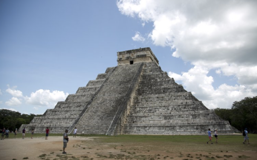
The term “monuments” can mean many things, ranging from the remains of a pre-Hispanic Maya home, or carved stones, all the way up to remains of temple platforms. It was not clear how many of each type of artefact was detected, but Mexico’s National Institute of Anthropology and History said at least 91 were large-scale structures like plazas, pyramid or temple platforms.
Mayan houses were generally relatively insubstantial, with stone bases topped by thatch and wooden structures of which little remains.
The institute said in a statement that the builders of the train would have to take “specific measures” to avoid damaging the artefacts, but did not say whether that meant parts would have to be re-routed.
In July, President Andrés Manuel López Obrador inaugurated the start of construction on the “Maya Train,” a pet project of his that would run some 950 miles (about 1,500 kilometers) in a rough loop around Yucatan.
The train is intended to connect Caribbean beach resorts to the peninsula’s interior, with largely indigenous populations and ruin sites, in a bid to stimulate economic development around its 15 stations. The government says it will cost as much as $6.8 billion, but others say it will be much more.
Critics say López Obrador rammed through the project without adequate study of its effects on the environment, underground sinkhole caves known as cenotes, and ruin sites.
Some stretches of the route already have tracks, and the institute said some artefacts had already been disturbed by railway construction decades ago. But other stretches are to push through sensitive jungle terrain, though they will parallel existing roads or transmission lines. Even where an old railway line exists, the project would imply updating tracks and building new stations.
Some Mayan communities have filled court challenges against the project, arguing that it will cause environmental damage. They also say they were not adequately consulted about it or they will not share in its benefits.
LiDAR, which stands for Light Detection and Ranging, involves shooting a pulsed laser at the ground to get a high-resolution, detailed image of the surface, even through dense vegetation.
The Mayas formed a sprawling empire of city-states across the Yucatan and Central America between 2,000 B.C. and A.D. 900, and their descendants still live on the peninsula.